posted by Decision Innovation Solutions on Wednesday, November 6, 2019
According to the October 28th USDA Crop Progress report, Iowa still only had 26% of corn harvested and 66% of soybeans, which are both well behind the 5-year averages of 53% and 80%, respectively. Last year was an exceptionally wet fall with many rainfall records in September and October across Iowa, but this year has been another extremely wet fall which is causing harvest delays.
The following map shows the total combined precipitation at various locations for September and October 2019. As you can see, precipitation across the state was as high as 21 inches in Dubuque, which also was an area that received record high precipitation last fall.
Overall, total 2019 September/October precipitation for these locations across Iowa are, on average, 5 inches greater than the prior 20-year precipitation averages in September and October.
.png)
The graphs below for various locations across the state are based on data from the ISU Mesonet dataset and show September and October precipitation from 1951 to 2019.
Charles City has had 8 years with 10+ inches of rainfall in September and October. The highest year was in 2016 with 18.7 inches. 2019 was the 5th wettest September/October in the Charles City location. You’ll notice that 2016, 2018, and 2019 were all very high years. October was particularly wet with 6.6 inches which was the 2nd highest October rainfall.
.png)
.png)
Cherokee has had four years with September and October precipitation exceeding 10 inches, however 2019 also came close with 9.7 inches. The 5 inches of precipitation in October 2019 was the third wettest October in the Cherokee location following 2009 and 1970 with 7.3 and 6.4 inches, respectively.
.png)
.png)
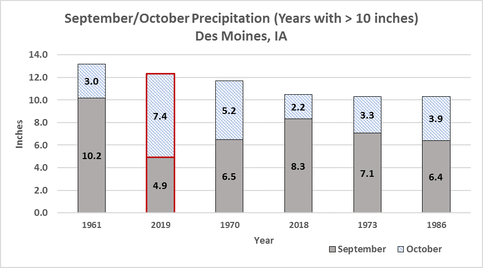
This October set a new precipitation record for the Des Moines area with 7.4 inches in October alone for a combined 12.3 inches in September and October. Des Moines has had 6 years since 1951 with over 10 inches of precipitation in September/October, with two of those years being this year and last year.
.png)
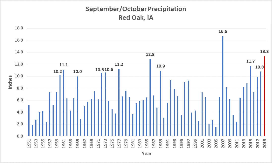
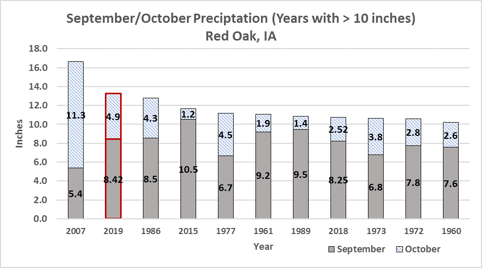
Red Oak has had 12 years since 1951 with 10+ inches of rainfall in September/October. 2019 was the second highest with 13.3 inches following 2007 with 16.6 inches.
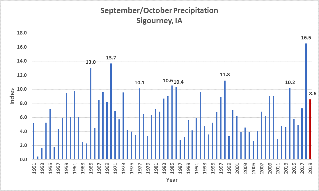
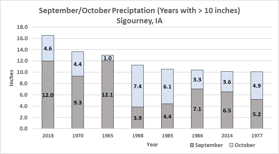
Sigourney had a record setting 2018 for September/October precipitation with 16.5 inches. This year has been much lower, with only 8.6 inches, but that is still almost 2.5 inches greater than the previous 20-year average September/October precipitation in that location.